Saturday, May 29, 2010

East Station Wood Waterpipe Mystery

Friends of the Saline Valley Salt Tram
SaltTram.blogspot.com    SalineValleySaltTram@gmail.com
As the years pass, researching the true story of the Salt Tram is getting more difficult, as the abundant photos and written first hand accounts from that era find their way into landfills (instead of museums). We  are striving to rediscover the efforts of those who built and ran the Salt Tram, in order to give proper recognition to their hopes, dreams and abundant sweat from an era that is rapidly fading from our memories.  We are actively seeking out information about the mining of Salt in Saline Valley between 1903 and the 1950's, including: documents, photos, articles, stories, artifacts, etc. If you can help us out, please email us at the address above - Thank-you! --Tim and Brian Waag, the Waag brothers (aka E. Clampus Waagus). 
Caution (PLEASE READ): Climbing around on the tramway is dangerous because its really old and defnitely unsafe, so don't even think about it. Shoot, just getting to it requires some perilous hiking, and if you don't believe me, just take a look at the Zig Zag Access Trail (or what's left of it). Plus, climbing on it weakens it and endangers your life. Also, the Saline Valley Salt Tram is on the National Register of Historic Places and should be treated with the respect that it deserves. What little remains is of great historic value, and should not be disturbed in any way. Heck, its probably against the law to move parts of the tram around, and certainly a crime to take home some of the few bits of it that remain (though you'd have to ask your friendly local BLM agent for details). So please treat it with the respect it deserves, so that future generations can enjoy whats left, without you messing it up. Really. Please. You can see its listing on the National Register of Historic Places at these web links:
National Register of Historic Places 1          National Register of Historic Places2 

******************************************************
QUESTION 1:  What is the Station Number on the east side of the Salt Tram where the wood water pipe is located? Answer: Station 18 (answer courtesy of Alan).


QUESTION 2: What are the dimensions (length, diameter, circumference) of the pipe at both Station 18 and at the Salt Lake?

******************************************************
On June 12, 2010, we received an email from Bob S:
Hi  Tim and Brian,
     I was up at the salt tram summit station recently. Took a hike down the east side of the tram station in hopes of getting to the second control station. When I reached the second or third station from the top [2nd station], I believe they are called the anchorage and tension stations, I noticed  something that looks like a large diameter wooden water pipe lying alongside of the station. Do not know why the tram would have a water pipe there unless it was being transported over the mountain to the salt lake and it fell off the tram or a burro and it was left there. During your travels down the east side do you recall seeing it? See pictures 9A and 10A. You will have to zoom in on it. 
 I continued my hike down the east side and stopped at a point where there was two telephone poles. See picture 12A. It was at this spot that I could no longer see where the trail was and was not sure if the structure in the distance below me was the control station. Can you tell me if the structure I am referring to beyond the telephone poles is the second control station? [Yes, it is - see photo below] Since it had taken me 2 hours to reach this spot and I was not sure if the structure was indeed the control station, so I decided to head back up to the summit. It took me 4 3/4 hours to get back to the summit. It was a great day even though I did not reach my objective. I guess I am going to have to invest in a GPS and make things a little easier for myself. 
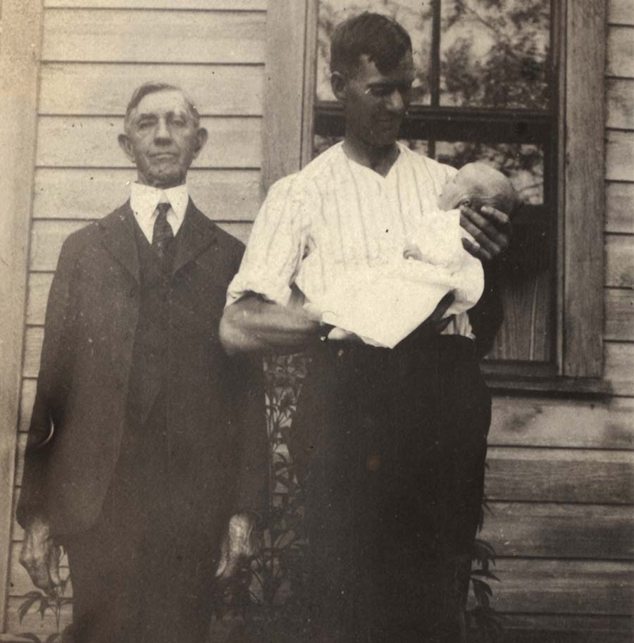
Best Regards, Bob S. 
 Our Reply: Hi Bob, yes, we have seen the waterpipe. It took us a while to figure out what the water pipe was doing alongside Station 18. The tramway was used for what they call in the tram vernacular "back traffic". Very handy when your operation is in the remote Saline Valley. (Brian at Station 18 with wood water pipe; click to enlarge):


It matches the waterpipes used down at the Salt Lake for transporting water from Hunter Spring to the the Salt Lake Evaporation Ponds. We have traced the water pipes down at the lake, and it is a combination of wooden water pipes and steel ones (click to enlarge):


Below: Steel water pipe at Salt Lake Marsh housing area in the lower left corner of the photo (click to enlarge; photo Courtesy Eastern California Museum):
Below: Steel water pipe being channeled into culvert for use in the salt evaporation ponds at the Salt Lake (click to enlarge; photo Courtesy Eastern California Museum):
Bob is correct that the circled Station in the photo is Control Station 2 (aka Station 15). Below is Bob's photo:


As Bob notes, the trail does indeed disappear from here. However, we believe that we have discovered where the every-so-faint trail goes in this area, and in fact, the Go-Devil route cuts through this general area as well. From the power pole above, there are 2 more stations between you and CS II (including the temp tramway. GPS may not have helped out.... :-)  The trail does, however, resume on the North side of Daisy Canyon, once you get to the bottom of it.

************click to go to SALT TRAM HOME************

Sunday, May 23, 2010

The Face of White Smith: Finally Found!

Friends of the SALINE VALLEY SALT TRAM
www.SaltTram.blogspot.com   SalineValleySaltTram@gmail.com
As the years pass, researching the true story of the Salt Tram is getting more difficult, as the abundant photos and written first hand accounts from that era find their way into landfills (instead of museums). We  are striving to rediscover the efforts of those who built and ran the Salt Tram, in order to give proper recognition to their hopes, dreams and abundant sweat from an era that is rapidly fading from our memories.  We are actively seeking out information about the mining of Salt in Saline Valley between 1903 and the 1950's, including: documents, photos, articles, stories, artifacts, etc. If you can help us out, please email us at the address above - Thank-you! --Tim and Brian Waag, the Waag brothers (aka E. Clampus Waagus).
Caution (PLEASE READ): Climbing around on the tramway is dangerous because its really old and defnitely unsafe, so don't even think about it. Shoot, just getting to it requires some perilous hiking, and if you don't believe me, just take a look at the Zig Zag Access Trail (or what's left of it). Plus, climbing on it weakens it and endangers your life. Also, the Saline Valley Salt Tram is on the National Register of Historic Places and should be treated with the respect that it deserves. What little remains is of great historic value, and should not be disturbed in any way. Heck, its probably against the law to move parts of the tram around, and certainly a crime to take home some of the few bits of it that remain (though you'd have to ask your friendly local BLM agent for details). So please treat it with the respect it deserves, so that future generations can enjoy whats left, without you messing it up. Really. Please. You can see its listing on the National Register of Historic Places at these web links:
National Register of Historic Places 1          National Register of Historic Places 2

*********************************************************************************
QUESTION1: Now that we have captured the image of White Smith's face, its time for his signature. Is the signature of the photo annotation below that of White Smith? If not, we are seeking his signature for our records.

QUESTION2: Identify the building (presumably in Bishop) that is tagged with the horizontal sign that reads "BANK". It is identified perhaps as being "City Market" but that just doesn't sound right.

QUESTION3: Identify all the White Smith brothers (and sisters?) that contributed to the financing, management, construction and operation of the Salt Tram. So far we are certain that Eugene and Fred meet this criterion. We also know that older brother Ambrose was the first Smith brother to move from Tennessee to Owens Valley, but we doubt that he worked on the Salt Tram in any meaningful way (wonder what the census shows as the occupation of brother Ambrose? - Brian? - See if Brian is reading this!!!).

*********************************************************************************
The Eastern California Museum in Independence casually lobbed us a little tidbit about the Salt Tram recently. While speaking with them on the phone, Roberta "casually" mentioned "oh, did you have that [confirmed] photo of White Smith, currenty at the ECM?". Uh, nope! In fact, that was one of our great frustrations. 

One of the powerpoint slides in our Salt Tram presentation to various groups addresses the very fact that we are missing a confirmed photo of White Smith, the first President of the Saline Valley Salt Company. We have been confident all along that one of the many photos of the "people of the Salt Tram" includes White Smith - its just that we don't know which one he is! Here's the Power Point that we use (click to enlarge):
In the presentation, Tim refers to the left image, where he says "Here is a group of Salt Tram workers at the Salt Lake, including White Smith. Except we don't know if White Smith is one of these gentleman or not."

That is, until now.

Ironically, it turns out that White Smith IS in this photo, and we believe 1 or 2 of his brothers are in it as well. White Smith is the 3rd man from the left. We believe that this photo was taken some time around 1913.

However, the photo from Roberta at ECM was taken in 1926, a long 13 years later. Here is our first glimpse of White Smith in 1926, in the photo from the Eastern California Museum:
 Sadly, the photo is oversatured in White's facial area, robbing us of quite a bit of detail in that area. Here's the photo that this image was pulled from (click to enlarge):
Roberta from the ECM also included the annotation that was found with this photo. Here's the readable one, which appears to be a transcription of the sloppy one (which follows afterwards):

However, a few words in the first annotation appear to be missing when transcribed from the lower, sloppy one. Here's my best transcription of what these two say:
City Market, Bishop, Sierra Salt Co., White Smith
Six Cylinder - Six wheel Moreland
truck. Loaded with ten tons of Salt.
Brought out over new Saline Road 
and sold and delivered to City Market -
Bishop, Cal. June 16, 1926.
First load brought out over new road.
--White Smith

Of course, the "New Saline Road" is none other than the San Lucas Canyon road. Roberta believes that the signature may be that of White Smith, but it is unfortunately, cut off on the scan.

Now that we have a photo of White Smith, its time to see if we have other photos of him in our Salt Tram photo archive. We immediately located a nearly identical one to the photo from ECM where White Smith, Esq. is identified. We believe that this photo was taken on the same day and in the same location as the ECM photo above. However, note that the truck was moved to (in what is in my opinion) a better location for the photo. White Smith is circled in red. We made a careful study of the high res version of both photos, and determined that it was the same truck: the salt bags matched exactly, as did the ropes and other small details about the truck that would change from load to load. Remember the annotated date of June 16, 1926. Click to enlarge.
Without a doubt, the guy in the both images, believed to be White Smith, is identical, as can be seen here:
In these 1926 photos, White Smith would have been about 73 years old, which looks about right. Also, we currently believe that he died in 1927, although that information is still a bit weak. This would explain how aged Mr. Smith looks in these photos. The question now is: do we have any photos of a younger White Smith? This brings us back to the slide show image, which is magnified below (click to enlarge):
Once again, the man shown 3rd from the left is believed to be none other than Mr. White Smith, Esq., except that this photo was taken 13 years before, in 1913. Below you can see a comparison of the 3 images, and many of the features of the two 1926 photos match the "younger" Smith on the far right: similar hat, stocky, similar ears and nose, and well-dressed like the President of a company.
We will continue to peruse our historical Salt Tram photo collection to see if we have another images that match the 3 above.

In the meantime, here is a photo from historical "Frashers Photo of Pomona", which annotates the photo with a date of June 15, 1926 for the first load of salt over the "New Saline Road", a discrepancy of one day (June 16, 1926) from the annotation of the earlier photo:
However, neatly hidden away on the right side of the tree is a sign painted on the building which says "Lone Pine Garage". We believe that the first load of salt out of Saline Valley over the treacherous San Lucas Canyon Road was taken out on June 15, 1926 as the photo immediately above indicates. It may have been parked overnight in Lone Pine, then driven the nearly 60 miles from Lone Pine to Bishop the next day, arriving at the June 16, 1926 annotation of the breakthrough photo. This assumes that we identify the photo of the Salt Truck in front of the "BANK" building as being in Bishop.

Thanks, Eastern California Museum for all the help!

*********************************************************************************
Previously, we had mentioned that we believed that not only was White Smith in some of our photos, but his brothers as well. Brian can fill this in better, but we know that Eugene and Fred Smith were heavily involved in the Salt Tram enterprise. Pulling from the "People of the Salt Tram" section of this blog, we find a bevy of Smith's:


Smith, E. E. – Director of the Saline Valley Salt Co. (6/23/1911 Inyo Independent); E = Eugene – brother of White Smith?
Smith, F. R. – Secretary and Treasurer (6/23/1911 Inyo Independent) – Director (6/23/1911 Inyo Independent); F = Fred – brother of White Smith?
Smith, J. W. – Local Manager  (Doc02: ASCE 1917); J = Jed? – brother of White Smith?
Smith, Ned – came to Independence from Bishop to get pack animals for Salt Tram survey (3/24/1911 Inyo Independent); brother of White Smith?
Smith, White – President (6/23/1911 Inyo Independent, Doc02: ASCE 1917) – Director (6/23/1911 Inyo Independent) - Finance and Executive Committee (6/23/1911 Inyo Independent) – mentioned in Henry Clifton Patterson diary
Smith, Will L. – Director (6/23/1911 Inyo Independent) – Finance and Executive Committee (6/23/1911 Inyo Independent) – Secretary (Doc02: ASCE 1917) – mentioned in Henry Clifton Patterson diary

Of those listed above, Eugene, Fred, Jed and Ned Smith are all believed to be siblings of White Smith. Only White's right-hand man, Will L. Smith, is definitely NOT related to White Smith.

There are several unidentified people that are shown repeatedly in our early Salt Tram era photos (i.e., 1911- 1913) that we now believe are some of White Smith's brothers. Here is another example of two of them:
The left photo shows these 2 potential Smith brother's at the Salt Lake (in a photo that we have already seen in this blog post above) and the same 2 gentlemen on a different day, but this time the photo is taken at the Discharge Station in Tramway. There is a mild family resemblance to White Smith, and these are clearly Salt Tram manager types, and not workers (if you saw what the Salt Tram workers looked like you'd know what we mean!).

Brian lists in the "White Smith Geneaology" section of this blog, all the known siblings of White Smith (those in BOLD are known to have worked on the Salt Tram with White):

Henrietta P (born 15 Feb 1846)
Eudocia Carolina (born 19 Feb 1848)
Ambrose Henry (born 16 June 1850)
James White (born 10 Feb 1853)
Lucy Annabelle (born 10 Jan 1856)
Edward Bell (born 30 March 1859)
Fred Robert (born 3 Feb 1862)
Eugene Ewart (born 24 Jan 1865)

Jessie J (born 2 Aug 1868)


Note that absent from this list is a Ned or a Jed Smith. Edward Ball or Jessie J could have possibly been referred to in a nickname as Ned or Jed Smith; conversely, the newspapers of the time could have simply gotten their names wrong - we don't know, but we will get to the bottom of this one too!


*****************************************************************************************

Thursday, May 13, 2010

Where is White Smith's Bishop Home?

Friends of the SALINE VALLEY SALT TRAM
www.SaltTram.blogspot.com   SalineValleySaltTram@gmail.com
As the years pass, researching the true story of the Salt Tram is getting more difficult, as the abundant photos and written first hand accounts from that era find their way into landfills (instead of museums). We  are striving to rediscover the efforts of those who built and ran the Salt Tram, in order to give proper recognition to their hopes, dreams and abundant sweat from an era that is rapidly fading from our memories.  
We are actively seeking out information about the mining of Salt in Saline Valley between 1903 and the 1950's, including: documents, photos, articles, stories, artifacts, etc. If you can help us out, please email us at the address above - Thank-you! --Tim and Brian Waag, the Waag brothers (aka E. Clampus Waagus).
Caution (PLEASE READ): Climbing around on the tramway is dangerous because its really old and defnitely unsafe, so don't even think about it. Shoot, just getting to it requires some perilous hiking, and if you don't believe me, just take a look at the Zig Zag Access Trail (or what's left of it). Plus, climbing on it weakens it and endangers your life. Also, the Saline Valley Salt Tram is on the National Register of Historic Places and should be treated with the respect that it deserves. What little remains is of great historic value, and should not be disturbed in any way. Heck, its probably against the law to move parts of the tram around, and certainly a crime to take home some of the few bits of it that remain (though you'd have to ask your friendly local BLM agent for details). So please treat it with the respect it deserves, so that future generations can enjoy whats left, without you messing it up. Really. Please. You can see its listing on the National Register of Historic Places at these web links:
National Register of Historic Places 1          National Register of Historic Places 2

*********************************************************************************
QUESTION1: Where was White Smith's home in Bishop? (White Smith was President of the Saline Valley Salt Company when it was selling shares in 1911 to build the Salt Tram).

QUESTION2: White Smith's Bishop home was sold in 1913 to the Bishop Presbyterian Church as a parsonage for the Reverend S. S. Patterson, who happened to be Salt Tram Diarist "Cliff" Patterson's father. Coincidence? We think not. Is the home still standing?

QUESTION3: Does it still serve as a parsonage for the Bishop Presbyterian Church?  

*********************************************************************************
According to the Inyo Register, February 13, 1913 edition, White Smith sold his Bishop home and moved to Los Angeles.

In May 2010, Tim was speaking with Roberta Harlan at the Eastern California Museum in Lone Pine. We were talking about various historical topics, and we (once again) were less than amused at the fact that we had no confirmed photo of White Smith [Update! As of May, 2010, we have a confirmed image of White Smith - thanks to Roberta and the ECM!]. I mentioned to Roberta that we recently found out that White (President of the Saline Valley Salt Co.) moved to Los Angeles, as reported in the Inyo Register of February 13, 1913.

See article below (click to enlarge):


We also noted that the March 13, 1913 Inyo Register (see article below) reported selling his residence to the Presbyterian Church to be used as the pastor's residence. Not coincidentally, the pastor of the Presbyterian Church was none other than S. S. Patterson, (Salt Tram Diarist) Cliff Patterson's Father!
 
In any case, Roberta is going to inquire at the current Presbyterian Church in Bishop
as to whether or not they still have the parsonage. Brian will have to determine
what tract number (from the census or poll records) contained White Smith's home
at that time.

Remember that White Smith did continue to be involved with the Salt Tram through
at least 1927, which is the currently reported year of his passing. Note that in 1913,
White Smith was approximatley 60 years old, having been born in 1853. However,
his daughter Margaret was at that time around 11 years old (in 1913).


Photo below (Courtesy Patterson family of Bishop) shows Rev. S. S. Patterson on left, and "Cliff" Patterson holding his son Fred.


We wish you the best of luck, Roberta, and hope you find out more about the
Presbyterian Church and its parsonage. Brian, do you have info on the lot number
of White Smith's home from the census?


Below is what appears to by the Presbyterian Church's website, including a photo of the church. It is located at: 
585 North Main Street, Bishop, CA 93514
Phone: (760) 872-2261
First Presbyterian Church of Bishop, California 

*****************************************************************************************

Wednesday, May 12, 2010

Salt Tram Telephone Systems

Friends of the SALINE VALLEY SALT TRAM
www.SaltTram.blogspot.com   SalineValleySaltTram@gmail.com
As the years pass, researching the true story of the Salt Tram is getting more difficult, as the abundant photos and written first hand accounts from that era find their way into landfills (instead of museums). We  are striving to rediscover the efforts of those who built and ran the Salt Tram, in order to give proper recognition to their hopes, dreams and abundant sweat from an era that is rapidly fading from our memories.  
We are actively seeking out information about the mining of Salt in Saline Valley between 1903 and the 1950's, including: documents, photos, articles, stories, artifacts, etc. If you can help us out, please email us at the address above - Thank-you! --Tim and Brian Waag, the Waag brothers (aka E. Clampus Waagus).
Caution (PLEASE READ): Climbing around on the tramway is dangerous because its really old and defnitely unsafe, so don't even think about it. Shoot, just getting to it requires some perilous hiking, and if you don't believe me, just take a look at the Zig Zag Access Trail (or what's left of it). Plus, climbing on it weakens it and endangers your life. Also, the Saline Valley Salt Tram is on the National Register of Historic Places and should be treated with the respect that it deserves. What little remains is of great historic value, and should not be disturbed in any way. Heck, its probably against the law to move parts of the tram around, and certainly a crime to take home some of the few bits of it that remain (though you'd have to ask your friendly local BLM agent for details). So please treat it with the respect it deserves, so that future generations can enjoy whats left, without you messing it up. Really. Please. You can see its listing on the National Register of Historic Places at these web links:
National Register of Historic Places 1          National Register of Historic Places 2

*********************************************************************************
QUESTION1: Collect documentation of the phone systems built and used in the construction and operation of the Saline Valley Salt Tram.
QUESTION2: Specifically, when, where, what and by whom were the first Salt Tram telephone lines strung? Was there a separate phone system for construction of the Salt Tram vs. the operation of the tram once verything was built?
QUESTION3: Were the twin bells that we know existed at the tram stations for the timing of the carriers (buckets), or for the ringing of the phone. Our guess is that it was for the phone ringing, rather than "gong spacing", as we guess that the tram was a fairly noisy environment, and the phone had to be heard in order to receive critical communication, such as when buckets got off the line or got tangled up, and the line had to be stopped. See Timing Bell or Gong?

*********************************************************************************
There is now doubt that communication among management and workers was critical for both the construction of the Salt Tram and its subsequent operation. Towards this end, we know they used a phone system, and this post serves to document both our questions about the phone systems, as well as the answers that we find. Once again, if you can help us out with any of this, please step in and email us. Thanks!

First, lets start with what we know. Miraculously, we found a photo (Courtesy Eastern California Museum) of two bucket riders that includes what appears to be a crude, box-like telephone strapped to the side of the bucket. Getting onto the internet, I found that phones of that era pretty much looked like the box phones attached to a wall that we are so familiar with: mouthpiece attached to the lower part of the box, and the ear pieces on a cord that the user puts up to their ear, and then hangs it up on the side of the phone when they are done. Here's what that type of phone looks like (this is a 1910 Western Electric Model):

However, phones were beginning to advance in their appearance at that time as well, with some more resembling our modern phones, such as this 1910 Western Electric nickel plated model:
Obviously, the phone in the photo below (click to enlarge) has few design elements in common with the phones above, and indeed, I wasn't sure if it was even a phone. So what did I do? Get on the internet, where I found the following website: Cyber Telephone Museum
I "contacted them" at the Cyber Telephone Museum, where "Ron" emailed back the following:
"Hi Tim, Yes.  That's called a 'lineman's test set'  They were designed to be carried up a pole by the lineman and to connect to the open wire via alligator clips. Thanks, Ron. Visit:  Cyber Telephone Museum   http://www.museumphones.com"

 Above is a close-up zoom in of the phone attached to the Salt Tram carrier with the 2 people inside.

Obviously, I was pleased to find out that the object was indeed a type of telephone. So now we know what at least one type of Salt Tram Phone looked like. Off the top of my head, here are the ponderables for Salt Tram phone systems:
  1. We know they used a "lineman test set" style of phone.
  2. Cliff Patterson mentions in his diary on several occasions that he "moved the phone/telephone from Station x to Station y; with the obvious meaning that the phones were mobile during the time of Salt Tram construction, and that either phone lines were strung, or the phones somehow worked on the power pole lines that were installed
  3. I recall an Inyo Register article in early 1911 (early in the construction phase; I believe it was even before the first tram building materials arrived) that said that telephone lines had been strung.
  4. On our May 2010 trip, it became obvious from examining Stations 20 through 23 that 2 wires were strung along the tram line, and it is likely that they were telephone lines, and not power lines. This means that what we shall call the "permanent" phone lines were strung AFTER the tramway was built and the tram cables strung. This also means that the earlier 1911 telephone lines that were strung were of a temporary nature. This makes sense, as it would be necessary to have communication between the various work groups and camps, and the transporters of the Salt Tram construction material during the construction phase.
Here's what a modern "lineman's test set" style phone looks like:
I also found this 1940's test set that looks much like the one in our Salt Tram photo:
    *****************************************************************************************

    Go-Devil Route Found May 2010!

    Friends of the SALINE VALLEY SALT TRAM
    www.SaltTram.blogspot.com   SalineValleySaltTram@gmail.com
    As the years pass, researching the true story of the Salt Tram is getting more difficult, as the abundant photos and written first hand accounts from that era find their way into landfills (instead of museums). We  are striving to rediscover the efforts of those who built and ran the Salt Tram, in order to give proper recognition to their hopes, dreams and abundant sweat from an era that is rapidly fading from our memories.  
    We are actively seeking out information about the mining of Salt in Saline Valley between 1903 and the 1950's, including: documents, photos, articles, stories, artifacts, etc. If you can help us out, please email us at the address above - Thank-you! --Tim and Brian Waag, the Waag brothers (aka E. Clampus Waagus).
    Caution (PLEASE READ): Climbing around on the tramway is dangerous because its really old and defnitely unsafe, so don't even think about it. Shoot, just getting to it requires some perilous hiking, and if you don't believe me, just take a look at the Zig Zag Access Trail (or what's left of it). Plus, climbing on it weakens it and endangers your life. Also, the Saline Valley Salt Tram is on the National Register of Historic Places and should be treated with the respect that it deserves. What little remains is of great historic value, and should not be disturbed in any way. Heck, its probably against the law to move parts of the tram around, and certainly a crime to take home some of the few bits of it that remain (though you'd have to ask your friendly local BLM agent for details). So please treat it with the respect it deserves, so that future generations can enjoy whats left, without you messing it up. Really. Please. You can see its listing on the National Register of Historic Places at these web links:
    National Register of Historic Places 1          National Register of Historic Places 2

    *********************************************************************************
     Update: October 2010 -  Recently, our head Salt Tram geek, Tom, converted the Go-Devil route into some GPS file formats. One of the formats was able to be input into Google Earth, where we were able to obtain the following images. The first image is the entire Go-Devil route (click to enlarge):
    Below is the same Go-Devil Route as above with two changes: (1) its imported and displayed in the National Geographic Topo Software - California, version 4.2.8 for Macintosh (2) the route is smoothed out to more accurately represent the actual route, subtracting Tom and Brian's explorative deviations from the route itself. Click to enlarge.


    DISCUSSION REGARDING THE RECENTLY FOUND GO-DEVIL ROUTE
    Tom and Brian traced the entire route in May 2010, and Tom produced GPS lat/long coordinates for it. Thanks Tom. Now trying to get clean routes of it, and the adjoining pack trail. We'd love to get the lat/longs for the Go-Devil route into our National Geographic topo software somehow - none of the formats below could be opened with National Geographic topo software - bummer.

    REPLY TO FRED: Yeah, me too. I need to buy a good GPS and learn how to use it. I want to get the trails onto my National Geographic topo software somehow. Brian hasn't figured out how to do it yet, either. Part of the problem is that we use Macintosh computers, which do not work well with GPSs, as well as the Mac version of the National Geographic topo software is buggy and often crashes.

    Tom sent the following files for the Go-Devil route:
    1 - .gdb = Garmin MapSource GPS waypoint database
    2 - .gpx = GPS eXchange is XML-based, developed as a common GPS data format for software applications.
    3 - .kml = Keyhole Markup Language is XML-based, developed for use with Google Earth [used this format as input to Google Earth]
    4 - .kmz = zipped .kml files

    Not sure what to do with 1, as I don't have a Garmin GPS (except on my boat!). In theory, I should be able to open 2 with the National Geographic topo software, but I tried it and it did not work. Apparently not that common of a GPS data format! 3 and 4 are essentially the same, and I was able to open 3 in Google Earth, but it would not display the lat/long coordinates in the file - at least that I could figure out, and I can't get a detailed map from it, as you can't stitch together the separate little pieces that it lets you export in jpg format, as the perspective changes as you move along the route.

    Also, I confirmed with Tom and Brian that the minor deviations (or major sometimes) deviations in the route are due to them exploring off to the side, and NOT because the Go-Devil route squiggles all over the place! Here's just one example - a close up of the entire route shown above (click to enlarge).

    On Oct 21, 2010, at 10:24 PM, Fred Dickson wrote: Could not open attach # 2  the gdb   or #3  the gpx.  What I was looking for was 2 trail lines one depicting the foot/mule trail and one depicting the Go Devil trail BOTH on the same map. Sort of an overlaid.

    *********************************************************************************
    On our May 2010 Salt Tram trip, Brian and Tom finally found the route. After all of us were searching for it on one day, Tom and Brian got up early and pinpointed the entire route. The route does indeed start near the Salt Tram Summit Station, and crosses the scree slope between Station 16 and 17, where it ends up in the Daisy Canyon bottom, just above the anchor point for the Temporary Construction Tram. A victory for the home team!

    We have been looking for this route for some time, and we finally found it. Tom has the GPS coordinates for the entire route, so that we can record its location for all time. Unfortunately, we will NOT be posting it on this website, due to the fact that there are a small number of significant Salt Tram artifacts along the route that we would like to remain there. Sorry, guys. (If you join the "Friends of the Saline Valley Salt Tram" team, we just might show you where it is!).

    More details to follow, but for now, here are 3 photos taken by Brian that show the cut logs and branches that mark parts of the Go-Devil route (click to enlarge):


    Here's an email quote from Tom after the May 2010 trip (regarding the finding of the Go-Devil route): "I think the combination of these cuts, tree stumps cut flush with the grade, lack of anything similar left or right of the path, the mostly consistent grade, lack of any obstacles and a subtle swale to the path, pretty much nails this as a some sort of purposely selected and cleared path. What else could it be? Brian gets all the credit for spotting the cut limbs to begin with. --Tom"

    *****************************************************************************************